UT Students Help Scientists Understand the Hill Country Floods
In the fall of 2025, a group of 12 students huddled around their laptops in a dark room in the Jackson School of Geosciences building. Their screens, displaying colorful swirls over a map of Central Texas, emitted a jolt of color into the space. Most of them had never done climate modeling before. And as residents of Central Texas, their first project hit close to home. They were all dedicated to modeling the same extreme weather event: the July 4, 2025, rainstorm that had devastated the Texas Hill Country only a few months earlier.
This storm caused catastrophic flooding that killed at least 139 people, including 37 children. Even for people who hadn’t lost a friend or family member in the flood, the weather event loomed large in the students’ memory and in the University community. The project carried emotional weight.
When the assignment was announced, Elizabeth Chapa, at the time a third-year climate system science major, immediately called her parents to tell them what she’d be working on.
“I get to apply what we’re learning to something that’s happening in the real world—something that affected so many different people,” Chapa says, recalling how she felt at the time. “All across Texas, this was a huge deal.”
Edward Vizy, a research scientist in the Department of Earth and Planetary Sciences, teaches GEO 347G, or Climate System Modeling, once every couple of years. Typically, he lets students decide the weather event that they’ll model over the course of the class. But after this summer storm devastated an area so close to the UT Austin campus—a tragedy that impacted so many students and alumni—he decided to dedicate the entire class to it.
“I’m sure many of the students were in the area, and they certainly know the aftermath of it,” Vizy says. “I thought it was a very relevant case to look at.”
While the class set out to understand the climatological factors that made this rainstorm so severe, what they discovered was that the storm in fact could have been even worse.
In a paper recently published in Geophysical Research Letters, Vizy and Jackson School of Geosciences professor Kerry Cook analyzed the class’s work and discovered that above-average sea surface temperatures weakened an air current known as the Great Plains low-level jet, thus weakening this enormous rainstorm.
Had sea surface temperatures in the Gulf of Mexico been at the 40-year average for this week in early July, the researchers estimate that rainfall totals could have been 5-8% higher over Central Texas. Vizy says it would take further work to quantify how exactly this would have impacted flood levels.
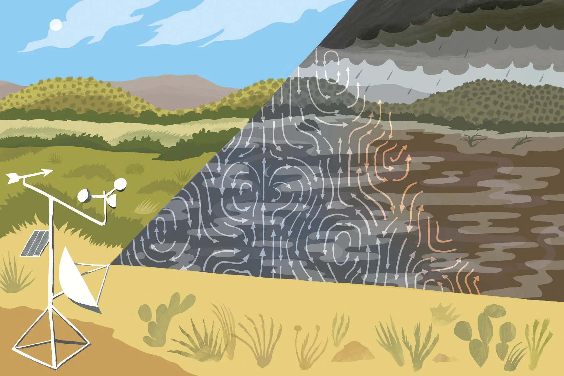
Instead, warmer-than-average sea surface temperatures reduced the contrast between land and ocean temperatures, slowing down the jet. The Great Plains low-level jet is a fast-moving current of air that curves from the Gulf of Mexico over Texas, the Great Plains, and the eastern United States. As the jet stream’s winds hit the higher terrain of the Texas Hill Country, they are forced upward, triggering a mechanism that can cause storms to develop and intensify. A weaker low-level jet means weaker storms and less intense rainfall.
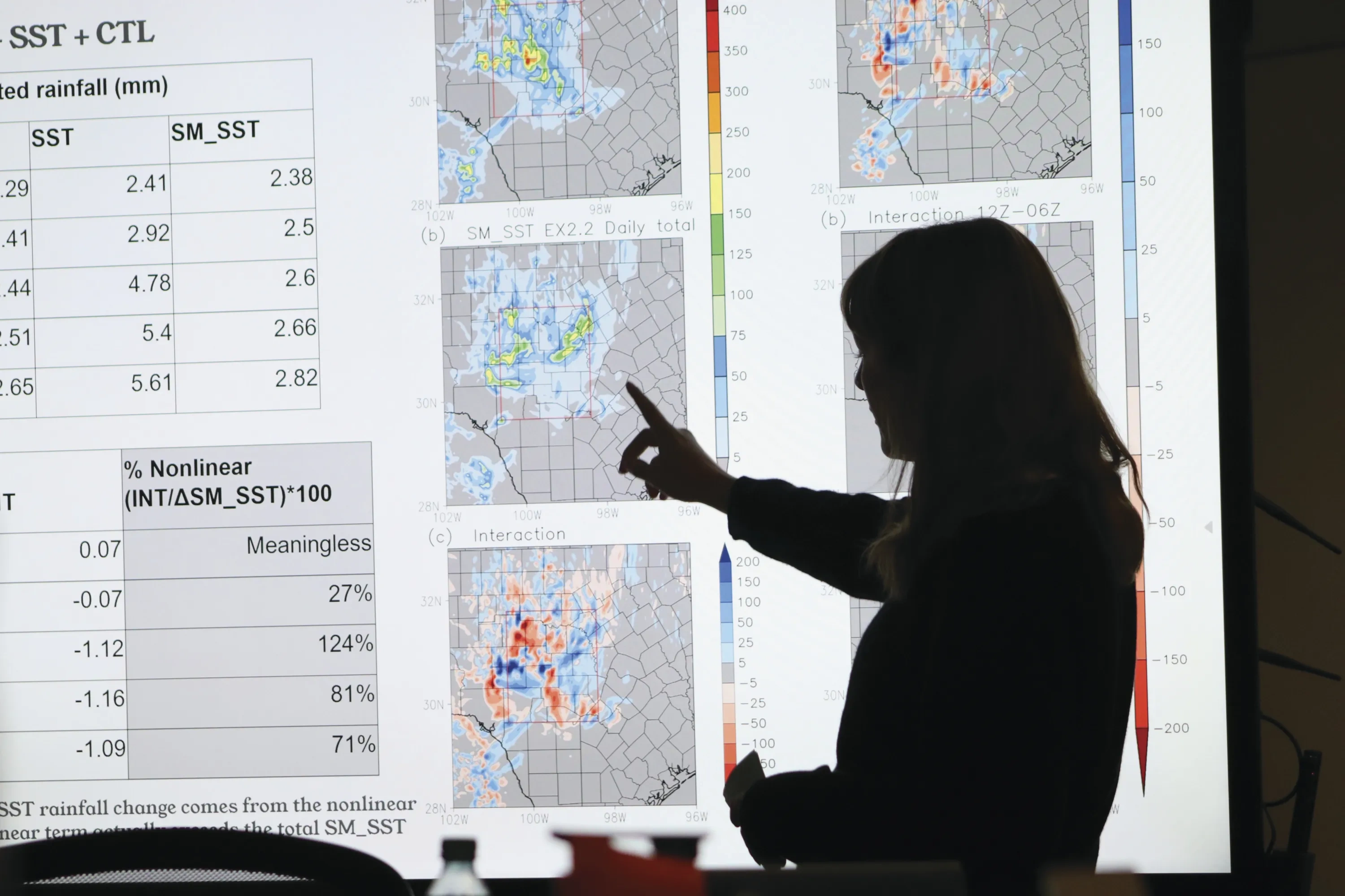
There are many factors that contribute to how a storm develops. Vizy and Cook concentrated on the storm’s relationship to sea surface temperatures and soil moisture because these factors can inform the prediction of future storms.
“Sea surface temperatures in the Gulf of Mexico, soil moisture—these surface conditions are more persistent than the storm itself,” Cook says. “So, it gives you a leg up on predictability. There’s memory there. That’s what can help with lead times.”
The models are very similar to those that forecasters run for weather prediction. Cook says that forecasters and climate scientists at the Austin/San Antonio office for the National Weather Service will see the results from this study. She hopes it will help them better understand the role of the Great Plains low-level jet in storm development when predicting and preparing for future storms.
Soil moisture also contributed to the development of the storm: Soils in the region were wet following Tropical Storm Barry, an on-the-ground condition that can enhance precipitation totals. Vizy and Cook found that soil moisture not only acted as a source of moisture for storm development, but it also influenced the circulation and the low-level jet strength, which affected rainfall totals.
For the first few weeks of the semester, the students worked to model the storm exactly as it occurred, working to simulate how, when, and where the rain fell, as compared with satellite observations, radar data, and ground conditions. The class then made a series of changes to the models’ surface conditions, changing sea surface temperatures and soil moisture to their average values to see how the storm would change.
These perturbation simulations, as they’re called, were run on the high-performance supercomputers at the Texas Advanced Computing Center (TACC), which completed them in a matter of hours. This access to TACC is what made it possible for the class to present on their findings in the span of one semester, Vizy says.
And to have 12 students be able to complete all these runs added to the robustness of the final study. “It was certainly a huge help to have the students help with these runs,” Vizy says. “You can only imagine how much time it takes to prepare, set up, and get a run going.”
After the paper was published, Chapa says she felt proud to have contributed to the findings. “[This storm] directly affected everyone in this class,” Chapa says. “The scientific question was so specific to us and to Texans—that makes it even more special that we got to contribute.”
CREDITS: From top, Corey Corcoran; courtesy of the Jackson School of Geosciences