UT Professor’s Research About the Connection Between Texas and Antarctica Wins Polar Medal
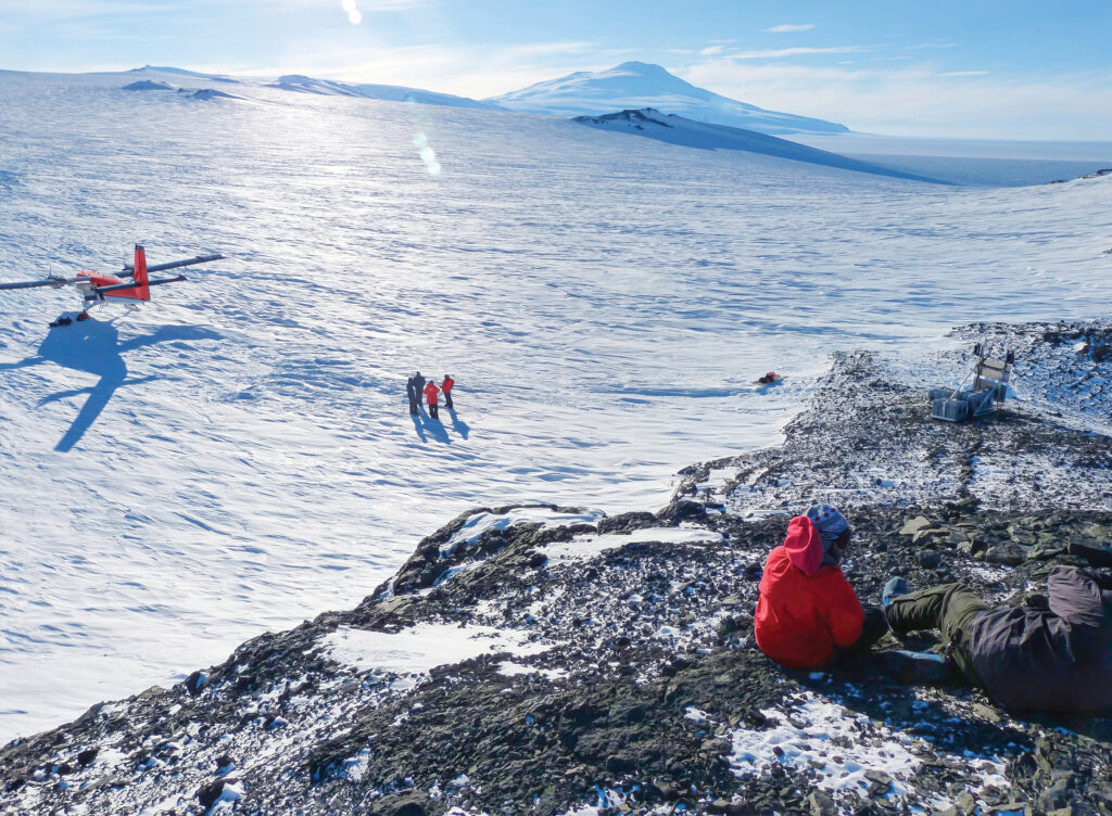
In 1987, Ian Dalziel, a professor and senior research scientist at the Jackson School of Geosciences’ Institute for Geophysics, was flying over the Pensacola Mountains in Antarctica’s interior. He was admiring the majestic outcropping of rock towering above the desolate landscape, when he found his mind wandering back to the geology of the southwestern United States that he had left only a few days earlier. As Dalziel gazed upon the dark brown sandstone cliffs topped with a white limestone nearly as brilliant as the surrounding ice, he was struck by the remarkable similarity between the ancient Precambrian geology of the Pensacola range and his new home in Texas. Like all geologists, Dalziel had made a career of noticing subtle connections between far-flung rock formations that might offer clues about Earth’s ancient geological history. But even he was surprised to see the similarities between the geology of Trans-Pecos Texas and the Transantarctic Mountains—an unanticipated connection that ultimately helped transform our understanding of ancient Earth.
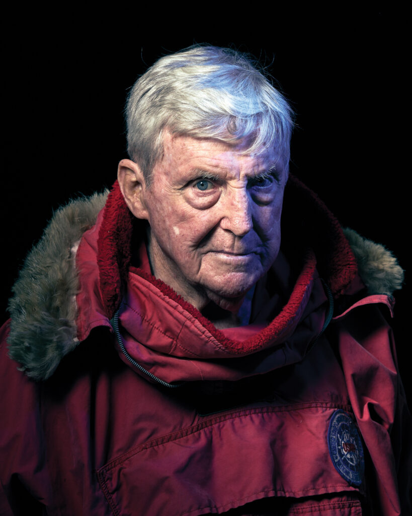
This fall, Dalziel will be honored with the Polar Medal, an award given by the government of the United Kingdom and presented by a member of the British Royal Family to scientists who have spent significant time exploring and researching Antarctica. Since his first visit in 1969, Dalziel has visited the interior of Antarctica, its coastlines, and the surrounding Southern Ocean so many times he stopped keeping track years ago. (At last count, he was north of 50.) The son of two actors, Dalziel grew up spending his summers exploring the rugged Scottish Highlands with his parents, which is where he first discovered his love of wild places, adventure, and geology.
“Like most British kids, I grew up on a steady diet of [polar explorers] Robert Scott and Ernest Shackleton,” Dalziel says.
Reading about the adventures of these early Antarctic explorers eventually inspired him to apply for the British Antarctic Survey when he graduated from the University of Edinburgh, but he withdrew his application because he would not have been able to apply his work toward a PhD. So Dalziel continued his doctoral geology work in the Scottish Highlands before embarking to America in 1963, where he briefly worked as an assistant professor at the University of Wisconsin. There he met Robert Dott, Jr., a renowned figure in the geological community who introduced Dalziel to the U.S. Antarctic Research Program of the National Science Foundation.
It was an exciting time to be a young geologist. When Dalziel arrived in Wisconsin, continental drift was still just a 50-year-old theory backed by limited evidence confined to the continents. But by the time he left Wisconsin for Columbia University in 1967, an overwhelming body of evidence from the sea floor forcefully underscored the reality of continental drift, and the race was on to decipher Earth’s ancient geological history. At the time, many geologists already believed that Earth’s continents were connected in a supercontinent called Pangea as recently as 180 million years ago. An unanswered question, however, was whether Pangea was the original supercontinent or if other landmasses had preceded it.
Shortly after arriving at Columbia, Dalziel visited Antarctica for the first time on an expedition to the South Shetland Islands off the coast of the Antarctic Peninsula. He was immediately taken by the continent’s rugged beauty and isolation.
“At the time it was just so untouched,” Dalziel says. “That pristine nature was just incredibly compelling.”
Over the course of the next decade, Dalziel had the opportunity to visit Antarctica several more times and finally fulfill his dream of following in the footsteps of his childhood heroes. But it wasn’t until he left Columbia for The University of Texas in the mid-1980s that he made the observation that would leave a profound impact on our understanding of the planet as it existed nearly 1 billion years ago.
Dalziel’s decision to come to UT was ultimately a pragmatic one. After climbing the career ladder at an Ivy League university, he missed working out in the field and was attracted by the University to continue his field work in Antarctica and facilitate research in the polar regions.
“I never came to Texas expecting to look at Texas rocks in a serious way,” Dalziel says with a laugh.
But that all changed after his trip to the Pensacola range.
To Dalziel’s trained eye, the boundary between the sandstone and limestone layers of Antarctica’s Pensacola range was an unmistakable record of one of the most foundational events in our planet’s history.
The Pensacola’s sandstone layers were deposited around 750 million years ago, a time when the first multicellular soft-bodied organisms were just starting to appear on the planet, as Earth’s tectonic plates moved apart, and waters flooded into the resulting valley depositing layer upon layer of eroded soil. Multitudes of cone-shaped sea sponges congregated in the resulting shallow seas, and their skeletons eventually hardened into the limestone that capped the range.
Dalziel knew that the rifting event that created the majestic sandstone face of the range indicated that East Antarctica must have broken off from another landmass hundreds of millions of years before the formation of Pangea. But at the time of his excursion, the question of which landmass ancient Antarctica had broken away from was a subject of heated debate among geologists. Yet as Dalziel considered the remarkable similarity between the Pensacola and West Texas geology, it dawned on him that he had perhaps found the answer: Although it had just taken him nearly 30 hours to fly from Texas to the Pensacola range, perhaps some 500 million years ago you could have—in principle—walked from Austin to what is now the South Pole.
It was an interesting idea, but Dalziel had traveled to Antarctica for other investigative purposes, so he filed it away for later investigation. Two years later, Dalziel returned to Antarctica on an expedition sponsored by the National Science Foundation that brought together geological experts from around the world with the aim of pushing Antarctic geology into the mainstream. Following the field trip, one of Dalziel’s colleagues, the late Eldridge Moores of the University of California at Davis, read an article suggesting that the Pacific coasts of Canada and Australia may once have been connected, which would suggest that the Pacific margins of Antarctica and the western U.S. may have been connected, too. He sent Dalziel a map highlighting the structural similarities of the continents for a “sanity check.” Dalziel’s casual observation from two years earlier about the similarity between Pensacola and the geology of West Texas flashed before his mind, and he resolved to get to the bottom of this titillating question.
After validating the theory with regard to scale using a sophisticated tectonic modeling software developed at UT called PLATES, Dalziel made several trips to Antarctica throughout the 1990s to collect rock samples that could potentially resolve the mystery. Before long, the evidence was overwhelming: Antarctica did indeed appear to have broken off from Laurentia, the ancient precursor of the modern North American continent. This discovery blew the field of Precambrian paleogeography wide open and led to a boom in research that seeks to piece together the supercontinental precursors of Pangea.
“That field trip that I led in 1989 was more successful than we could have ever dreamed when we proposed it to the National Science Foundation,” Dalziel says. “It led to many new hypotheses about supercontinental cycles, and that’s really in the forefront of modern research.”
Dalziel’s pioneering Antarctic discoveries established him as something of a celebrity among geologists, a status that was officially recognized in 2021 when he was awarded the Penrose Medal by the Geological Society of America—the highest honor in the field. But Dalziel was never one to rest on his laurels. For the past two decades, he has made countless visits to Antarctica that have led to more groundbreaking discoveries about the ancient history of our planet. Moreover, he led a team that established the first network of GPS stations for measuring ice mass change in the critically vulnerable West Antarctic Ice Sheet, research which is ongoing today led by one of his former students, Terry Wilson of Ohio State University.
Although Dalziel doesn’t get down to Antarctica as much as he’d like these days, his work continues to inspire the new generations of geologists and explorers who are pushing the boundaries of understanding the Earth’s ancient history.
“It has been very rewarding to contribute to our understanding of the geologic history of the stark but beautiful continent isolated at the bottom of the world,” Dalziel says. “As my younger colleagues seek to recover and study samples from beneath the ice sheet, they are not only testing the hypotheses of my generation, but helping to understand the problems that will be faced by many generations to come. I wish them well.”
CREDITS: Ian Dalziel (2); Matt Wright-Steel; Rick Tomlinson
Share this article
-

Starting Here: Meet the 2024 President’s Leadership Award Winners
-

World-Changers Reconnect With the University Through the Tower Fellows Program
-

Taking Over From Legendary Swim Coach Eddie Reese Is Another Legend
-

Racing Ahead: The 2024 President’s Impact Award
-

The Long Game Brings Local Heroes From the Putting Green to the Silver Screen
-

Beloved Director Celebrates 30 Years Leading the Scottish Rite Dormitory
-
Starting Here: Meet the 2024 President’s Leadership Award Winners
-
World-Changers Reconnect With the University Through the Tower Fellows Program
-
Taking Over From Legendary Swim Coach Eddie Reese Is Another Legend
-
Racing Ahead: The 2024 President’s Impact Award


1 Comment