The Way Back: College On a Hill
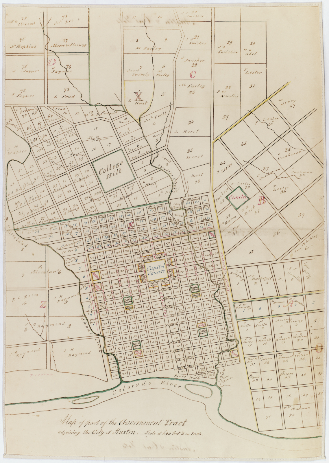
In 1838, the fledgling town of Austin—then called Waterloo—was selected as the future site for both the Capitol and The University of Texas. As such, the original plans for the Forty Acres are nearly as old as the Republic of Texas itself. This 1858 map, with its “college hill” and “capitol square,” depicts the lofty ambition the founding generation of Texans had for the town. It would be a center for both government and higher education.
This strangely familiar layout shows how present-day Austin remains defined by its rivers, creeks, and institutions. And yet, the map shows a very different city as well: one of hundreds of residents rather than today’s hundreds of thousands (and quickly gaining on a million). Capitol Square hosted a ramshackle building that burned down on a rainy November morning in 1881. And College Hill was then just a hill. To our eyes, with its lots and labels, this is more of a vision than a map—but a vision that is slowly, imperfectly, and continually being realized.
Image courtesy the Dolph Briscoe Center for American History